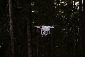
How are drones being used to help manage forests? Is it local or world-wide?
First, let’s distinguish between drones, Unmanned Aerial Vehicles (UAV), and Unmanned Aircraft Systems (UAS), or whether they can be used interchangeably. UAVs, while the term currently used most frequently, is not the official term used by many countries’ aviation agencies so most likely will eventually disappear from common usage in favor of Remotely Piloted Aircraft System, RPAS. Drone is the term used by many french speaking countries, who are the pioneers in setting regulations for commercial unmanned aerial vehicles. Often used in a military context, ‘drone’ is also ubiquitous in day-to-day common usage. While drone and UAV describe the aircraft itself, UAS is used by the US and UK to describe the system—the aircraft, the control station and the data link. Acknowledging that there are also differences between the various types of drones, for simplicity, this blog will use the generic term ‘drone’ to include quad-, octo-, tri- and hexacopters, Micro Air Vehicles, small UAS, etc.
So, how can we use drones in forestry? Grind Drone lists uses of drones, such as for:
- forest mapping and biodiversity
- extent of canopy cover and gaps therein
- estimating number of trees
- depth of snow in forest
- extent of carbon storage within a forest
- aerial surveys of fire damaged areas and rainforests
- monitoring illegal quarrying and logging.
SmartPlanes adds:
- detecting and managing outbreaks of pests and diseases
- mapping weeds and other growth.
The U.S. Forest Service has been exploring the use of drones for several years and has tested different platforms during controlled burns and non-fire situations. Since drones are considered the same as manned aircraft, U.S. Forest Service must abide by the same FAA regulations to fly these drones. Members of the U.S. Forest Service have obviously considered drone usage, as their FAQ page delineates, for forest management, watershed, soil and air management, forest health protection, fish and wildlife, research, and others. The Service also owns at least three small platforms, but has no plans to operate them, even though the usefulness was shown in 2013 to provide real time information during the Rim Fire in Northern California.
Drones are also being used overseas, for instance in helping save Myanmar’s Mangrove Forests; in Portugal, Brazil and possibly world-wide for biomass mapping; studying tropical forests; and managing the financial incentive of carbon offsets. While regulations to ensure drones do not hamper traditional flying craft (airplanes, helicopters), interfere with emergency responders, or affect personal privacy are still being developed, it is clear that drones could be of much use to forest services around the world to help with managing health and well-being, mapping, and detecting illegal uses of the world’s forests. — Lloyd Chesley


